Itinerary
Your holiday starts at the hotel in Kathmandu. Transfers from Kathmandu Airport are provided. Depending on your arrival time, you may have the opportunity to explore the immediate vicinity of the hotel and get acclimatised to this bustling city. Alternatively, you may prefer to recover from your journey by relaxing at the hotel. Your guide will take dinner with you and will provide an informal briefing about the days ahead.
After a 4am pick up from the Kathmandu hotel, we drive 5 hours to Ramechhap where we check in for a late morning, 20 minute flight to Lukla. (Outside of the peak trekking season, flights to Lukla may operate directly from Kathmandu). Landing at Lukla, on the narrow, sloping runway in the heart of the mountains, is a spectacular way to reach the Khumbu. Here, we meet our trekking crew and set off on the first stage of our trek which initially takes us downhill to Surke (2300m) beside the Dudh Kosi River. From here, still heading south (on the original Jiri to Everest trail), we climb through terraced farmland for a couple of kilometres and then contour around into a sparsely forested tributary valley and reach our lodge accommodation at Paiya (2780m).
Shortly after leaving the lodge we turn onto a meandering trail that takes us up into a forest of rhododenron and oak. We cross a ridge a little above 3000 metres and then descend into the valley of the Khari Khola at around 2400 metres before ascending again to Pangkongma (2850m) where there is a small monastery. We pass several small farming settlement on today's relatively untrekked route.
A great day of trekking which begins with a climb up to the Pangkongma La (3174m) on the main watershed separating the valleys of the Dudh Kosi and Hinku Khola. We have our first sight of Mera Peak before making a steep descent to the village of Sibuje (2770 m). From here the trail is undulating as we make our way through the forested river valley to Ning So (2850m).
We have a steep climb up to a tea house at 3280 metres, which affords tremendous views. We then continue to climb to our high point of the day at 3350 metres, before a steep descent back to the river and a welcome lunch stop. After lunch we have a roller coaster afternoon through the forest with some steep sections of trail. At the end of the day we cross the river on a remarkable bridge made from a huge tree trunk to reach our accommodation at 'Jungle Camp' (3160m).
Heading north we follow the Hinku Khola through the moss covered trees with many ups and downs as we negotiate side valleys and rock ridges. Our overall elevation gradually increases and finally, after crossing a broad ridge of mixed forest, we reach a sandy boulder-choked area known as Gotay at an altitude of 3600 metres. There are several seasonal lodges and shops here in this otherwise uninhabited part of the Hinku Valley.
Following the west bank of the Hinku Drangka northwards, the forest eventually disappears and the valley widens and becomes much more open. There are no villages in the Upper Hinku, only small kharkas used for grazing goats, sheep and yaks. The twin summits of Kusum Kanguru appear on the left while the valley is bounded on the right by the steep rock face of Mera's satellite peak. Ahead framed in the sharp V of the valley is the imaginatively named Peak 43. We will take lunch at Gondishung, a summer herders’ settlement consisting of a few roofless huts and stone-walled enclosures, as well as a long ancient ‘mani’ wall of intricately carved prayer stones. Beyond Gondishung we pass nearby a fascinating 200 year-old gompa built beneath a massive boulder, and a number of crude mani walls. It is well worth visiting this gompa to burn some juniper at the shrine, an offering that just might ensure a successful ascent of Mera Peak. From the gompa it is an hour’s walk over moraines to the yak herders' settlement of Tagnag. Once similar in appearance to Gondishung, nowadays there are several teahouses here. The group will spend at least two nights at Tagnag (4350m) before moving up to Mera Basecamp.
A day for acclimatisation. One option for an acclimatisation walk is to trek up the nearby ridge coming down from Kusum Kanguru, where we can reach an altitude of just over 5000 metres on the hill known as Shartemba Go. Here, we have spectacular views of Kusum Kanguru and of our route up onto the Mera La. At the leader’s discretion, part of today may also be used to run through various techniques and safety procedures to be used during the climbs.
Heading up from Tagnag towards the Mera Basecamp at Khare, a good trail leads up and across the moraine which dams Charpatti Tal, and reaches a high point lined with cairns overlooking this glacial lake in about 30 minutes. From here the trail descends slightly to cross a sandy bowl and then climbs alongside a khola or stream to the large pasture of Dig Kharka. Here we cross the khola on stepping stones and then climb for a further hour and a half to Khare, the basecamp for Mera Peak at an altitude of approximately 5000 metres.
Another day for acclimatisation. At the leader’s discretion, part of today may also be used to practice techniques and safety procedures to be used on our climbs. There are some interesting day hikes from Khare. Above camp it is possible to climb to a high moraine ridge, from where there are good views of the Mera La and the route up the mountain. This will also be a time for final preparation of our equipment and packing of our mountain bags.
Leaving basecamp we first climb to the crest of the moraine above Khare and then make a direct approach across a boulder strewn bowl to a steepening of the ground leading up to the Mera Glacier. We should reach this point in one and a half hours from Khare. The route continues via rocky steps and we may need to put on our crampons as we reach the first of the snow and ice. We ascend slowly and without any technical difficulty to a level site at around 5300 metres where we set up our next camp. Once the camp is established, our porters will descend back to Khare with instructions to return the following day to help carry to high camp. The climbing group will spend the afternoon drinking as much tea and soup as possible to help with acclimatisation.
There are several options for a high camp on the mountain but the best by far is behind the pinnacles at approximately 5800 metres. Here there is shelter from the wind, usually no snow, and well constructed platforms for several tents. It takes 3 to 4 hours to reach this site from our approach camp at 5300 metres. After the first half an hour’s climb, the view north into the main Himalaya opens out. First of the 8000 metre giants in view is the red pyramid of Makalu, then Everest with its cloud plume peeking over the impressive black wall of Lhotse. Later you can see to the north-west the large white girth of Cho Oyu. Arriving at high camp, if the weather has been kind, the beautiful massif of Kangchenjunga comes into view, far to the east. Five of the world's six highest mountains.
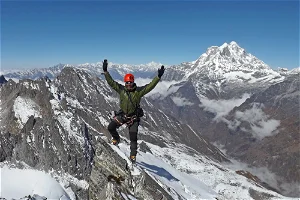
A 2.00 am wake up and after bed tea and a breakfast, the group will put on crampons and rope up before setting out for the summit. One of the great advantages of using our high camp, as well as making for a shorter summit day, is that we will have only around an hour of walking with head torches before dawn breaks. Climbing mostly easy angled snow slopes to the foot of the dome of the central summit, we will place a fixed rope for the last 30 to 40 metres which steepens to an angle of 45 - 50 degrees. Note that in certain snow conditions an ascent of the Central summit may be beyond the technical grade for this trek and in this case the group will make an ascent of the easier and slightly lower south summit. The trip leader will make this decision. From either top, the panorama of the Himalaya including five of the world's highest peaks is unforgettable. From our high camp a well acclimatised party will take 3 to 4 hours to the summit. From the summit we will descend first to our high camp for some tea or soup and from here all the way back down to our basecamp at Khare. A long but inspirational day!
Time
12 - 14 hrs trekking
This is a spare day which we can use if conditions are not favourable on the scheduled summit day. It is also useful to have a spare day in case of possible delays (including internal flight delays) on the approach to the mountain.
We retrace our route, descending the beautiful Hinku Valley and stopping en route to pay our respects at the shrine in Gondishung. We set up our camp in a clearing in the forest at Gotay.
Today we climb up through the lush forest on the west side of the Hinku Valley to Tuli Kharka below the Zatwra La. On occasion, we can look back to the impressive south face of Mera.
The last 300 to 400 metres of the ascent to the Zatrwa La will be our last climb of the trip, with superb views southwards across the ridge and valley landscape of Nepal's Middle Hills. From the crest of the pass we trek downhill, steeply in places, for almost 2000 metres to the welcoming lodges of Lukla.
After saying goodbye to our Sherpa crew, we board the flight to Ramechhap and from there transfer by road to Kathmandu. (Outside of the peak trekking season, flights may operate directly back to Kathmandu). Arriving late afternoon, the rest of the day is free for sightseeing or shopping amongst the streets and bazaars of the Nepalese capital. In the evening there will be a celebratory meal and time to reflect on our Mera Peak adventure.
This is an important contingency day in case of delays to the flights from Lukla. If we have experienced no delays this is another opportunity for independent exploration amongst the colourful streets and temples of Kathmandu.
Your holiday ends after breakfast. Transfers to Kathmandu Airport are provided. To extend your holiday in Nepal, why not pre-book a day's sightseeing tour in the Kathmandu Valley, or a multi-day excursion to the wildlife reserve at Chitwan. Contact our office for details.
Download Trip Notes
The Route
Use two fingers to move the map
Airport
Peaks
Point
Direction
Pass
Array
(
[0] => Array
(
[id] => 01hgdf2y32wcc11g2ae0ea0yk3
[name] => MER Mera Peak Climb
[code] => MER
[ordering] => 1
[introduction] =>
[description] => 5 nights hotels & lodges, 14 nights camping, 15 days trekking and climbing, Max altitude - 6476 metres, Join in Kathmandu, MEAL PLAN: All meals included
[map] => Array
(
[id] => 01j00wx55y1zwvsbjgcx4awdf8
[title] => MER
[data] => {"type": "FeatureCollection", "zoom": 12, "center": [27.650625499153186, 86.80890980360948], "features": [{"type": "Feature", "geometry": {"type": "Point", "coordinates": [86.72787666320801, 27.687328288239016]}, "properties": {"icon": {"iconUrl": "//www.keadventure.com/libraries/mrzen/assets/images/map-icons/airport.png", "iconType": "airport"}, "type": "Marker"}}, {"type": "Feature", "geometry": {"type": "Point", "coordinates": [87.17857360839844, 28.10711481248363]}, "properties": {"text": "New%25252525252520Label", "type": "Label"}}, {"type": "Feature", "geometry": {"type": "Point", "coordinates": [86.92502975463867, 27.988186621074206]}, "properties": {"icon": {"iconUrl": "//www.keadventure.com/libraries/mrzen/assets/images/map-icons/peak_large.png", "iconType": "peak_large"}, "type": "Marker"}}, {"type": "Feature", "geometry": {"type": "Point", "coordinates": [86.923828125, 27.991369850942526]}, "properties": {"text": "Everest", "type": "Label"}}, {"type": "Feature", "geometry": {"type": "Point", "coordinates": [86.86863899230957, 27.709366865606754]}, "properties": {"icon": {"iconUrl": "//www.keadventure.com/libraries/mrzen/assets/images/map-icons/peak_large.png", "iconType": "peak_large"}, "type": "Marker"}}, {"type": "Feature", "geometry": {"type": "Point", "coordinates": [86.85791015625, 27.69295270201824]}, "properties": {"text": "Mera Peak", "type": "Label"}}, {"type": "Feature", "geometry": {"type": "Point", "coordinates": [86.88760757446289, 27.718560956029304]}, "properties": {"icon": {"iconUrl": "//www.keadventure.com/libraries/mrzen/assets/images/map-icons/point.png", "iconType": "point"}, "type": "Marker"}}, {"type": "Feature", "geometry": {"type": "Point", "coordinates": [86.89241409301758, 27.743859698309247]}, "properties": {"icon": {"iconUrl": "//www.keadventure.com/libraries/mrzen/assets/images/map-icons/point.png", "iconType": "point"}, "type": "Marker"}}, {"type": "Feature", "geometry": {"type": "Point", "coordinates": [86.84211730957031, 27.737478587451]}, "properties": {"icon": {"iconUrl": "//www.keadventure.com/libraries/mrzen/assets/images/map-icons/point.png", "iconType": "point"}, "type": "Marker"}}, {"type": "Feature", "geometry": {"type": "Point", "coordinates": [86.79061889648438, 27.734288234266874]}, "properties": {"text": "Tagnag", "type": "Label"}}, {"type": "Feature", "geometry": {"type": "Point", "coordinates": [86.89876556396484, 27.73641546659948]}, "properties": {"text": "Khare", "type": "Label"}}, {"type": "Feature", "geometry": {"type": "Point", "coordinates": [86.79130554199219, 27.682616015041297]}, "properties": {"icon": {"iconUrl": "//www.keadventure.com/libraries/mrzen/assets/images/map-icons/pass_large_e_w.png", "iconType": "pass_large_e_w"}, "type": "Marker"}}, {"type": "Feature", "geometry": {"type": "Point", "coordinates": [86.82117462158203, 27.70693524103925]}, "properties": {"icon": {"iconUrl": "//www.keadventure.com/libraries/mrzen/assets/images/map-icons/point.png", "iconType": "point"}, "type": "Marker"}}, {"type": "Feature", "geometry": {"type": "Point", "coordinates": [86.7813491821289, 27.702680146192815]}, "properties": {"text": "Gotay", "type": "Label"}}, {"type": "Feature", "geometry": {"type": "Point", "coordinates": [86.77328109741211, 27.69416832296047]}, "properties": {"icon": {"iconUrl": "//www.keadventure.com/libraries/mrzen/assets/images/map-icons/arrow_w.png", "iconType": "arrow_w"}, "type": "Marker"}}, {"type": "Feature", "geometry": {"type": "Point", "coordinates": [86.81585311889648, 27.719092821841617]}, "properties": {"icon": {"iconUrl": "//www.keadventure.com/libraries/mrzen/assets/images/map-icons/arrow_n_e.png", "iconType": "arrow_n_e"}, "type": "Marker"}}, {"type": "Feature", "geometry": {"type": "Point", "coordinates": [86.846923828125, 27.725171104020344]}, "properties": {"icon": {"iconUrl": "//www.keadventure.com/libraries/mrzen/assets/images/map-icons/arrow_s_w.png", "iconType": "arrow_s_w"}, "type": "Marker"}}, {"type": "Feature", "geometry": {"type": "Point", "coordinates": [86.78398130927235, 27.591371143523844]}, "properties": {"text": "Ning So", "type": "Label"}}, {"type": "Feature", "geometry": {"type": "Point", "coordinates": [86.82037352118641, 27.635482228751684]}, "properties": {"text": "Jungle Camp", "type": "Label"}}, {"type": "Feature", "geometry": {"type": "Point", "coordinates": [86.82723997626454, 27.662244495358113]}, "properties": {"icon": {"iconUrl": "//www.keadventure.com/libraries/mrzen/assets/images/map-icons/arrow_n.png", "iconType": "arrow_n"}, "type": "Marker"}}, {"type": "Feature", "geometry": {"type": "Point", "coordinates": [86.8112754682079, 27.642021247006774]}, "properties": {"icon": {"iconUrl": "//www.keadventure.com/libraries/mrzen/assets/images/map-icons/point.png", "iconType": "point"}, "type": "Marker"}}, {"type": "Feature", "geometry": {"type": "Point", "coordinates": [86.77333830390126, 27.60399750408941]}, "properties": {"icon": {"iconUrl": "//www.keadventure.com/libraries/mrzen/assets/images/map-icons/point.png", "iconType": "point"}, "type": "Marker"}}, {"type": "Feature", "geometry": {"type": "Point", "coordinates": [86.62879942450672, 27.594109168464314]}, "properties": {"icon": {"iconUrl": "//www.keadventure.com/libraries/mrzen/assets/images/map-icons/pass_large_e_w.png", "iconType": "pass_large_e_w"}, "type": "Marker"}}, {"type": "Feature", "geometry": {"type": "Point", "coordinates": [86.7537689069286, 27.58072046201494]}, "properties": {"icon": {"iconUrl": "//www.keadventure.com/libraries/mrzen/assets/images/map-icons/pass_large_e_w.png", "iconType": "pass_large_e_w"}, "type": "Marker"}}, {"type": "Feature", "geometry": {"type": "Point", "coordinates": [86.7012977739796, 27.666197306051302]}, "properties": {"text": "Lukla", "type": "Label"}}, {"type": "Feature", "geometry": {"type": "Point", "coordinates": [86.75691606011242, 27.662550728871626]}, "properties": {"text": "Zatrwa La", "type": "Label"}}, {"type": "Feature", "geometry": {"type": "Point", "coordinates": [86.66902543511242, 27.694168322960543]}, "properties": {"icon": {"iconUrl": "//www.keadventure.com/libraries/mrzen/assets/images/map-icons/arrow_w.png", "iconType": "arrow_w"}, "type": "Marker"}}, {"type": "Feature", "geometry": {"type": "Point", "coordinates": [86.72830581665039, 27.643085721732]}, "properties": {"icon": {"iconUrl": "//www.keadventure.com/libraries/mrzen/assets/images/map-icons/point.png", "iconType": "point"}, "type": "Marker"}}, {"type": "Feature", "geometry": {"type": "Point", "coordinates": [86.74203872680664, 27.592587806880886]}, "properties": {"icon": {"iconUrl": "//www.keadventure.com/libraries/mrzen/assets/images/map-icons/point.png", "iconType": "point"}, "type": "Marker"}}, {"type": "Feature", "geometry": {"type": "Point", "coordinates": [86.70481434043415, 27.57320196723253]}, "properties": {"text": "Pangkongma", "type": "Label"}}, {"type": "Feature", "geometry": {"type": "Point", "coordinates": [86.65070666184567, 27.681640644404684]}, "properties": {"icon": {"iconUrl": "//www.keadventure.com/libraries/mrzen/assets/images/map-icons/arrow_e.png", "iconType": "arrow_e"}, "type": "Marker"}}, {"type": "Feature", "geometry": {"type": "Point", "coordinates": [86.71456469407224, 27.615342680747414]}, "properties": {"icon": {"iconUrl": "//www.keadventure.com/libraries/mrzen/assets/images/map-icons/arrow_s.png", "iconType": "arrow_s"}, "type": "Marker"}}, {"type": "Feature", "geometry": {"type": "Point", "coordinates": [86.80726183762692, 27.616559518984793]}, "properties": {"icon": {"iconUrl": "//www.keadventure.com/libraries/mrzen/assets/images/map-icons/arrow_n_e.png", "iconType": "arrow_n_e"}, "type": "Marker"}}, {"type": "Feature", "geometry": {"type": "Point", "coordinates": [86.61706103196286, 27.71203944063484]}, "properties": {"text": "Internal Flights", "type": "Label"}}, {"type": "Feature", "geometry": {"type": "Point", "coordinates": [86.61156786790036, 27.698665233460748]}, "properties": {"text": "from and to Kathmandu", "type": "Label"}}, {"type": "Feature", "geometry": {"type": "Point", "coordinates": [86.6905321012988, 27.633593834552048]}, "properties": {"text": "Paiya", "type": "Label"}}, {"type": "Feature", "geometry": {"type": "LineString", "coordinates": [[86.89241409301758, 27.743783734902095], [86.89258575439453, 27.74340391707172], [86.89292907714844, 27.742948133927186], [86.89327239990234, 27.742720241639788], [86.89413070678711, 27.741960597238545], [86.89473152160645, 27.741276912748393], [86.89498901367188, 27.740593223967597], [86.8952465057373, 27.739681632252353], [86.89567565917969, 27.73877003290963], [86.89541816711426, 27.737630523005347], [86.8952465057373, 27.73664293811512], [86.8952465057373, 27.73459177166548], [86.8952465057373, 27.734135951655567], [86.8952465057373, 27.73352818867652], [86.8952465057373, 27.733072364217875], [86.89576148986816, 27.732160709580906], [86.8960189819336, 27.731021130560492], [86.8960189819336, 27.7307172408093]]}, "properties": {"type": "Polyline", "color": "#E21C24", "weight": "2", "lineType": "trek"}}, {"type": "Feature", "geometry": {"type": "LineString", "coordinates": [[86.8960189819336, 27.730109458765018], [86.89576148986816, 27.730109458765018], [86.89533233642578, 27.730185431705895], [86.89464569091797, 27.73041335021081], [86.89370155334473, 27.730337377428803], [86.89292907714844, 27.72950167333151], [86.89267158508301, 27.728969858297006], [86.89267158508301, 27.728438040667704], [86.89275741577148, 27.727830245914127], [86.89275741577148, 27.727222447771503], [86.89275741577148, 27.72646269532748], [86.89275741577148, 27.72593086546602], [86.89275741577148, 27.725475009233964], [86.89275741577148, 27.72486719795934], [86.89275741577148, 27.72433536031417], [86.89224243164062, 27.723727542685612], [86.89146995544434, 27.722739831811758], [86.89018249511719, 27.721524175375635], [86.88983917236328, 27.7211442799597], [86.88863754272461, 27.720460464875462], [86.88820838928223, 27.719472724404994], [86.8879508972168, 27.718788898837957], [86.88760757446289, 27.718712917954672]]}, "properties": {"type": "Polyline", "color": "#E21C24", "weight": "2", "lineType": "trek"}}, {"type": "Feature", "geometry": {"type": "LineString", "coordinates": [[86.8868350982666, 27.71825703154325], [86.88614845275879, 27.717801143225937], [86.88554763793945, 27.716585431728937], [86.88546180725098, 27.71612953642354], [86.88494682312012, 27.715369706679496], [86.88468933105469, 27.714533887846716], [86.88383102416992, 27.713622078178442], [86.88305854797363, 27.712634275769144], [86.88177108764648, 27.71141850667698], [86.88005447387695, 27.711190548463605], [86.87816619873047, 27.710734630607693], [86.87790870666504, 27.710582657565602], [86.87722206115723, 27.710430684311785], [86.87653541564941, 27.710202724034055], [86.87636375427246, 27.709822789179242], [86.8758487701416, 27.70883495236387], [86.87559127807617, 27.70784710660343], [86.87464714050293, 27.70678326270418], [86.87361717224121, 27.70670727345726], [86.87241554260254, 27.706555294804694], [86.87129974365234, 27.706555294804694], [86.87104225158691, 27.706555294804694], [86.87078475952148, 27.70670727345726], [86.8703556060791, 27.70701123012732], [86.86975479125977, 27.70746716354457], [86.86941146850586, 27.707923095056437], [86.86915397644043, 27.708151060097826], [86.868896484375, 27.708682976675252]]}, "properties": {"type": "Polyline", "color": "#E21C24", "weight": "2", "lineType": "trek"}}, {"type": "Feature", "geometry": {"type": "LineString", "coordinates": [[86.84220314025879, 27.736946811342417], [86.84383392333984, 27.73770649070304], [86.84752464294434, 27.73839019759903], [86.85087203979492, 27.738466164767104], [86.85190200805664, 27.738466164767104], [86.85361862182617, 27.738466164767104], [86.85542106628418, 27.738466164767104], [86.85739517211914, 27.738466164767104], [86.85885429382324, 27.738466164767104], [86.86005592346191, 27.738466164767104], [86.86314582824707, 27.739149866896028], [86.8659782409668, 27.739985497004945], [86.86786651611328, 27.74173270288524], [86.86949729919434, 27.742568313183323], [86.8718147277832, 27.742796205788547], [86.87344551086426, 27.74340391707172], [86.8758487701416, 27.74401162496463], [86.87705039978027, 27.74401162496463], [86.88125610351562, 27.744467403659367], [86.88305854797363, 27.744467403659367], [86.88460350036621, 27.744467403659367], [86.88563346862793, 27.744467403659367], [86.88726425170898, 27.744467403659367], [86.88803672790527, 27.744467403659367], [86.88983917236328, 27.744543366589745], [86.89069747924805, 27.744543366589745], [86.89189910888672, 27.744391440676015], [86.89215660095215, 27.74408758821286]]}, "properties": {"type": "Polyline", "color": "#E21C24", "weight": "2", "lineType": "trek"}}, {"type": "Feature", "geometry": {"type": "LineString", "coordinates": [[86.7286491394043, 27.687328288238888], [86.73088073730469, 27.68717628260008], [86.73311233520508, 27.686568257928684], [86.73465728759766, 27.686264244323358], [86.73620223999023, 27.685960229871625], [86.73929214477539, 27.685200190039296], [86.74100875854492, 27.684896172625194], [86.74306869506836, 27.684744163600723], [86.74461364746094, 27.684440144917044], [86.74736022949219, 27.683680094504947], [86.75027847290039, 27.683832105010538], [86.75182342529297, 27.683832105010538], [86.75542831420898, 27.684896172625194], [86.75783157348633, 27.684896172625194], [86.75989151000977, 27.684896172625194], [86.76332473754883, 27.685504206607018], [86.7641830444336, 27.685504206607018], [86.76881790161133, 27.68641625123182], [86.77001953125, 27.68641625123182], [86.77362442016602, 27.686568257928684], [86.77499771118164, 27.686568257928684], [86.77688598632812, 27.68641625123182], [86.7780876159668, 27.68641625123182], [86.77997589111328, 27.68580822232835], [86.78186416625977, 27.684896172625194], [86.78289413452148, 27.684440144917044], [86.78598403930664, 27.683072050366672], [86.78787231445312, 27.682464002843012], [86.79079055786133, 27.682311990433135], [86.79353713989258, 27.68292003880315], [86.79851531982422, 27.685504206607018], [86.80194854736328, 27.687784303885763], [86.80641174316406, 27.69021635517035], [86.81070327758789, 27.693560337227762], [86.81465148925781, 27.696600232027926], [86.81894302368164, 27.69948805366992], [86.82031631469727, 27.703135719153323], [86.82031631469727, 27.704351580552178], [86.82151794433594, 27.70967081486681], [86.82374954223633, 27.713014200831434], [86.8278694152832, 27.717725161654432], [86.83198928833008, 27.722587875498494], [86.83319091796875, 27.725626961523115], [86.83456420898438, 27.72836206650885], [86.83799743652344, 27.732768480186238], [86.84057235717773, 27.735199528712794], [86.84228897094727, 27.737782458347812]]}, "properties": {"type": "Polyline", "color": "#E21C24", "weight": "2", "lineType": "trek"}}, {"type": "Feature", "geometry": {"type": "LineString", "coordinates": [[86.82106016669422, 27.711494492642235]]}, "properties": {"type": "Polyline", "color": "#010101", "weight": "2", "lineType": "internal_flight"}}, {"type": "Feature", "geometry": {"type": "LineString", "coordinates": [[86.58691400662065, 27.510707451811573], [85.3207396902144, 27.69325634309158]]}, "properties": {"type": "Polyline", "color": "#010101", "weight": "2", "lineType": "internal_flight"}}, {"type": "Feature", "geometry": {"type": "LineString", "coordinates": [[86.72424310818315, 27.685960229871625], [85.32348627224565, 27.68839232178566]]}, "properties": {"type": "Polyline", "color": "#010101", "weight": "2", "lineType": "internal_flight"}}, {"type": "Feature", "geometry": {"type": "LineString", "coordinates": [[86.72669219551608, 27.68682956310557], [86.71982574043795, 27.682573305794687], [86.71776580391452, 27.679228987250035], [86.71639251289889, 27.676188608805848], [86.71519088326022, 27.66965150861301], [86.71845244942233, 27.664330324382817], [86.72119903145358, 27.657792514805376], [86.72051238594577, 27.653991282982997], [86.72051238594577, 27.650189919012057], [86.72274398384616, 27.64745285513341], [86.72779083251953, 27.644758446801827]]}, "properties": {"type": "Polyline", "color": "#E21C24", "weight": "2", "lineType": "trek"}}, {"type": "Feature", "geometry": {"type": "LineString", "coordinates": [[86.72779083251953, 27.644758446801827], [86.73046874580905, 27.640838911026933], [86.73115539131686, 27.634299696976488], [86.73029413638153, 27.625782925419507], [86.7289208453659, 27.615440240586008], [86.73012247500458, 27.608899509270884], [86.7337273639206, 27.601492054264167], [86.73939218936005, 27.595711157296012], [86.7447136920456, 27.589625673215927], [86.75023605913836, 27.589473531786012], [86.75469925493914, 27.591603492593894], [86.75950577349383, 27.59738460619553], [86.76705887407977, 27.60286116941174], [86.77619934082031, 27.604149625361305]]}, "properties": {"type": "Polyline", "color": "#E21C24", "weight": "2", "lineType": "trek"}}, {"type": "Feature", "geometry": {"type": "LineString", "coordinates": [[86.77619934082031, 27.604149625361305], [86.78285172075945, 27.612292386710585], [86.7878299006911, 27.61715979409827], [86.7940097102614, 27.621722792062847], [86.80259277910906, 27.627198138626536], [86.80997421831805, 27.63662726020093], [86.81100418657977, 27.642253929550705]]}, "properties": {"type": "Polyline", "color": "#E21C24", "weight": "2", "lineType": "trek"}}, {"type": "Feature", "geometry": {"type": "LineString", "coordinates": [[86.81078877071663, 27.64282344058316], [86.81164707760139, 27.650122434305107], [86.81261768516072, 27.66020464510598], [86.81725254233845, 27.670847156210577], [86.81862583335408, 27.680576545070455], [86.81879749473103, 27.69258506435013], [86.81948414023884, 27.70018471051057]]}, "properties": {"type": "Polyline", "color": "#E21C24", "weight": "2", "lineType": "trek"}}]}
)
[fields] => Array
(
[0] => Array
(
[__typename] => BoolFieldData
[name] => all_meals_included
[bool] => 1
)
[1] => Array
(
[__typename] => NumberFieldData
[name] => group_size_maximum
[number] => 12
)
[2] => Array
(
[__typename] => NumberFieldData
[name] => group_size_minimum
[number] => 5
)
[3] => Array
(
[__typename] => StringFieldData
[name] => joining_point
[string] => Kathmandu
)
[4] => Array
(
[__typename] => StringFieldData
[name] => map_json
[string] => {"type":"FeatureCollection","zoom":11,"center":[27.650625499153186,86.80890980360948],"features":[{"type":"Feature","geometry":{"type":"Point","coordinates":[86.72787666320801,27.687328288239016]},"properties":{"type":"Marker","icon":{"iconType":"airport","iconUrl":"//www.keadventure.com/libraries/mrzen/assets/images/map-icons/airport.png"}}},{"type":"Feature","geometry":{"type":"Point","coordinates":[87.17857360839844,28.10711481248363]},"properties":{"type":"Label","text":"New%25252525252520Label"}},{"type":"Feature","geometry":{"type":"Point","coordinates":[86.92502975463867,27.988186621074206]},"properties":{"type":"Marker","icon":{"iconType":"peak_large","iconUrl":"//www.keadventure.com/libraries/mrzen/assets/images/map-icons/peak_large.png"}}},{"type":"Feature","geometry":{"type":"Point","coordinates":[86.923828125,27.991369850942526]},"properties":{"type":"Label","text":"Everest"}},{"type":"Feature","geometry":{"type":"Point","coordinates":[86.86863899230957,27.709366865606754]},"properties":{"type":"Marker","icon":{"iconType":"peak_large","iconUrl":"//www.keadventure.com/libraries/mrzen/assets/images/map-icons/peak_large.png"}}},{"type":"Feature","geometry":{"type":"Point","coordinates":[86.85791015625,27.69295270201824]},"properties":{"type":"Label","text":"Mera Peak"}},{"type":"Feature","geometry":{"type":"Point","coordinates":[86.88760757446289,27.718560956029304]},"properties":{"type":"Marker","icon":{"iconType":"point","iconUrl":"//www.keadventure.com/libraries/mrzen/assets/images/map-icons/point.png"}}},{"type":"Feature","geometry":{"type":"Point","coordinates":[86.89241409301758,27.743859698309247]},"properties":{"type":"Marker","icon":{"iconType":"point","iconUrl":"//www.keadventure.com/libraries/mrzen/assets/images/map-icons/point.png"}}},{"type":"Feature","geometry":{"type":"Point","coordinates":[86.84211730957031,27.737478587451]},"properties":{"type":"Marker","icon":{"iconType":"point","iconUrl":"//www.keadventure.com/libraries/mrzen/assets/images/map-icons/point.png"}}},{"type":"Feature","geometry":{"type":"LineString","coordinates":[[86.89241409301758,27.743783734902095],[86.89258575439453,27.74340391707172],[86.89292907714844,27.742948133927186],[86.89327239990234,27.742720241639788],[86.89413070678711,27.741960597238545],[86.89473152160645,27.741276912748393],[86.89498901367188,27.740593223967597],[86.8952465057373,27.739681632252353],[86.89567565917969,27.73877003290963],[86.89541816711426,27.737630523005347],[86.8952465057373,27.73664293811512],[86.8952465057373,27.73459177166548],[86.8952465057373,27.734135951655567],[86.8952465057373,27.73352818867652],[86.8952465057373,27.733072364217875],[86.89576148986816,27.732160709580906],[86.8960189819336,27.731021130560492],[86.8960189819336,27.7307172408093]]},"properties":{"type":"Polyline","weight":"2","color":"#E21C24","lineType":"trek"}},{"type":"Feature","geometry":{"type":"LineString","coordinates":[[86.8960189819336,27.730109458765018],[86.89576148986816,27.730109458765018],[86.89533233642578,27.730185431705895],[86.89464569091797,27.73041335021081],[86.89370155334473,27.730337377428803],[86.89292907714844,27.72950167333151],[86.89267158508301,27.728969858297006],[86.89267158508301,27.728438040667704],[86.89275741577148,27.727830245914127],[86.89275741577148,27.727222447771503],[86.89275741577148,27.72646269532748],[86.89275741577148,27.72593086546602],[86.89275741577148,27.725475009233964],[86.89275741577148,27.72486719795934],[86.89275741577148,27.72433536031417],[86.89224243164062,27.723727542685612],[86.89146995544434,27.722739831811758],[86.89018249511719,27.721524175375635],[86.88983917236328,27.7211442799597],[86.88863754272461,27.720460464875462],[86.88820838928223,27.719472724404994],[86.8879508972168,27.718788898837957],[86.88760757446289,27.718712917954672]]},"properties":{"type":"Polyline","weight":"2","color":"#E21C24","lineType":"trek"}},{"type":"Feature","geometry":{"type":"LineString","coordinates":[[86.8868350982666,27.71825703154325],[86.88614845275879,27.717801143225937],[86.88554763793945,27.716585431728937],[86.88546180725098,27.71612953642354],[86.88494682312012,27.715369706679496],[86.88468933105469,27.714533887846716],[86.88383102416992,27.713622078178442],[86.88305854797363,27.712634275769144],[86.88177108764648,27.71141850667698],[86.88005447387695,27.711190548463605],[86.87816619873047,27.710734630607693],[86.87790870666504,27.710582657565602],[86.87722206115723,27.710430684311785],[86.87653541564941,27.710202724034055],[86.87636375427246,27.709822789179242],[86.8758487701416,27.70883495236387],[86.87559127807617,27.70784710660343],[86.87464714050293,27.70678326270418],[86.87361717224121,27.70670727345726],[86.87241554260254,27.706555294804694],[86.87129974365234,27.706555294804694],[86.87104225158691,27.706555294804694],[86.87078475952148,27.70670727345726],[86.8703556060791,27.70701123012732],[86.86975479125977,27.70746716354457],[86.86941146850586,27.707923095056437],[86.86915397644043,27.708151060097826],[86.868896484375,27.708682976675252]]},"properties":{"type":"Polyline","weight":"2","color":"#E21C24","lineType":"trek"}},{"type":"Feature","geometry":{"type":"LineString","coordinates":[[86.84220314025879,27.736946811342417],[86.84383392333984,27.73770649070304],[86.84752464294434,27.73839019759903],[86.85087203979492,27.738466164767104],[86.85190200805664,27.738466164767104],[86.85361862182617,27.738466164767104],[86.85542106628418,27.738466164767104],[86.85739517211914,27.738466164767104],[86.85885429382324,27.738466164767104],[86.86005592346191,27.738466164767104],[86.86314582824707,27.739149866896028],[86.8659782409668,27.739985497004945],[86.86786651611328,27.74173270288524],[86.86949729919434,27.742568313183323],[86.8718147277832,27.742796205788547],[86.87344551086426,27.74340391707172],[86.8758487701416,27.74401162496463],[86.87705039978027,27.74401162496463],[86.88125610351562,27.744467403659367],[86.88305854797363,27.744467403659367],[86.88460350036621,27.744467403659367],[86.88563346862793,27.744467403659367],[86.88726425170898,27.744467403659367],[86.88803672790527,27.744467403659367],[86.88983917236328,27.744543366589745],[86.89069747924805,27.744543366589745],[86.89189910888672,27.744391440676015],[86.89215660095215,27.74408758821286]]},"properties":{"type":"Polyline","weight":"2","color":"#E21C24","lineType":"trek"}},{"type":"Feature","geometry":{"type":"LineString","coordinates":[[86.7286491394043,27.687328288238888],[86.73088073730469,27.68717628260008],[86.73311233520508,27.686568257928684],[86.73465728759766,27.686264244323358],[86.73620223999023,27.685960229871625],[86.73929214477539,27.685200190039296],[86.74100875854492,27.684896172625194],[86.74306869506836,27.684744163600723],[86.74461364746094,27.684440144917044],[86.74736022949219,27.683680094504947],[86.75027847290039,27.683832105010538],[86.75182342529297,27.683832105010538],[86.75542831420898,27.684896172625194],[86.75783157348633,27.684896172625194],[86.75989151000977,27.684896172625194],[86.76332473754883,27.685504206607018],[86.7641830444336,27.685504206607018],[86.76881790161133,27.68641625123182],[86.77001953125,27.68641625123182],[86.77362442016602,27.686568257928684],[86.77499771118164,27.686568257928684],[86.77688598632812,27.68641625123182],[86.7780876159668,27.68641625123182],[86.77997589111328,27.68580822232835],[86.78186416625977,27.684896172625194],[86.78289413452148,27.684440144917044],[86.78598403930664,27.683072050366672],[86.78787231445312,27.682464002843012],[86.79079055786133,27.682311990433135],[86.79353713989258,27.68292003880315],[86.79851531982422,27.685504206607018],[86.80194854736328,27.687784303885763],[86.80641174316406,27.69021635517035],[86.81070327758789,27.693560337227762],[86.81465148925781,27.696600232027926],[86.81894302368164,27.69948805366992],[86.82031631469727,27.703135719153323],[86.82031631469727,27.704351580552178],[86.82151794433594,27.70967081486681],[86.82374954223633,27.713014200831434],[86.8278694152832,27.717725161654432],[86.83198928833008,27.722587875498494],[86.83319091796875,27.725626961523115],[86.83456420898438,27.72836206650885],[86.83799743652344,27.732768480186238],[86.84057235717773,27.735199528712794],[86.84228897094727,27.737782458347812]]},"properties":{"type":"Polyline","weight":"2","color":"#E21C24","lineType":"trek"}},{"type":"Feature","geometry":{"type":"Point","coordinates":[86.79061889648438,27.734288234266874]},"properties":{"type":"Label","text":"Tagnag"}},{"type":"Feature","geometry":{"type":"Point","coordinates":[86.89876556396484,27.73641546659948]},"properties":{"type":"Label","text":"Khare"}},{"type":"Feature","geometry":{"type":"Point","coordinates":[86.79130554199219,27.682616015041297]},"properties":{"type":"Marker","icon":{"iconType":"pass_large_e_w","iconUrl":"//www.keadventure.com/libraries/mrzen/assets/images/map-icons/pass_large_e_w.png"}}},{"type":"Feature","geometry":{"type":"Point","coordinates":[86.82117462158203,27.70693524103925]},"properties":{"type":"Marker","icon":{"iconType":"point","iconUrl":"//www.keadventure.com/libraries/mrzen/assets/images/map-icons/point.png"}}},{"type":"Feature","geometry":{"type":"Point","coordinates":[86.7813491821289,27.702680146192815]},"properties":{"type":"Label","text":"Gotay"}},{"type":"Feature","geometry":{"type":"Point","coordinates":[86.77328109741211,27.69416832296047]},"properties":{"type":"Marker","icon":{"iconType":"arrow_w","iconUrl":"//www.keadventure.com/libraries/mrzen/assets/images/map-icons/arrow_w.png"}}},{"type":"Feature","geometry":{"type":"Point","coordinates":[86.81585311889648,27.719092821841617]},"properties":{"type":"Marker","icon":{"iconType":"arrow_n_e","iconUrl":"//www.keadventure.com/libraries/mrzen/assets/images/map-icons/arrow_n_e.png"}}},{"type":"Feature","geometry":{"type":"Point","coordinates":[86.846923828125,27.725171104020344]},"properties":{"type":"Marker","icon":{"iconType":"arrow_s_w","iconUrl":"//www.keadventure.com/libraries/mrzen/assets/images/map-icons/arrow_s_w.png"}}},{"type":"Feature","geometry":{"type":"Point","coordinates":[86.78398130927235,27.591371143523844]},"properties":{"type":"Label","text":"Ning So"}},{"type":"Feature","geometry":{"type":"Point","coordinates":[86.82037352118641,27.635482228751684]},"properties":{"type":"Label","text":"Jungle Camp"}},{"type":"Feature","geometry":{"type":"Point","coordinates":[86.82723997626454,27.662244495358113]},"properties":{"type":"Marker","icon":{"iconType":"arrow_n","iconUrl":"//www.keadventure.com/libraries/mrzen/assets/images/map-icons/arrow_n.png"}}},{"type":"Feature","geometry":{"type":"Point","coordinates":[86.8112754682079,27.642021247006774]},"properties":{"type":"Marker","icon":{"iconType":"point","iconUrl":"//www.keadventure.com/libraries/mrzen/assets/images/map-icons/point.png"}}},{"type":"Feature","geometry":{"type":"Point","coordinates":[86.77333830390126,27.60399750408941]},"properties":{"type":"Marker","icon":{"iconType":"point","iconUrl":"//www.keadventure.com/libraries/mrzen/assets/images/map-icons/point.png"}}},{"type":"Feature","geometry":{"type":"Point","coordinates":[86.62879942450672,27.594109168464314]},"properties":{"type":"Marker","icon":{"iconType":"pass_large_e_w","iconUrl":"//www.keadventure.com/libraries/mrzen/assets/images/map-icons/pass_large_e_w.png"}}},{"type":"Feature","geometry":{"type":"Point","coordinates":[86.7537689069286,27.58072046201494]},"properties":{"type":"Marker","icon":{"iconType":"pass_large_e_w","iconUrl":"//www.keadventure.com/libraries/mrzen/assets/images/map-icons/pass_large_e_w.png"}}},{"type":"Feature","geometry":{"type":"LineString","coordinates":[[86.82106016669422,27.711494492642235]]},"properties":{"type":"Polyline","weight":"2","color":"#010101","lineType":"internal_flight"}},{"type":"Feature","geometry":{"type":"LineString","coordinates":[[86.58691400662065,27.510707451811573],[85.3207396902144,27.69325634309158]]},"properties":{"type":"Polyline","weight":"2","color":"#010101","lineType":"internal_flight"}},{"type":"Feature","geometry":{"type":"LineString","coordinates":[[86.72424310818315,27.685960229871625],[85.32348627224565,27.68839232178566]]},"properties":{"type":"Polyline","weight":"2","color":"#010101","lineType":"internal_flight"}},{"type":"Feature","geometry":{"type":"Point","coordinates":[86.7012977739796,27.666197306051302]},"properties":{"type":"Label","text":"Lukla"}},{"type":"Feature","geometry":{"type":"Point","coordinates":[86.75691606011242,27.662550728871626]},"properties":{"type":"Label","text":"Zatrwa La"}},{"type":"Feature","geometry":{"type":"Point","coordinates":[86.66902543511242,27.694168322960543]},"properties":{"type":"Marker","icon":{"iconType":"arrow_w","iconUrl":"//www.keadventure.com/libraries/mrzen/assets/images/map-icons/arrow_w.png"}}},{"type":"Feature","geometry":{"type":"Point","coordinates":[86.72830581665039,27.643085721732]},"properties":{"type":"Marker","icon":{"iconType":"point","iconUrl":"//www.keadventure.com/libraries/mrzen/assets/images/map-icons/point.png"}}},{"type":"Feature","geometry":{"type":"Point","coordinates":[86.74203872680664,27.592587806880886]},"properties":{"type":"Marker","icon":{"iconType":"point","iconUrl":"//www.keadventure.com/libraries/mrzen/assets/images/map-icons/point.png"}}},{"type":"Feature","geometry":{"type":"LineString","coordinates":[[86.72669219551608,27.68682956310557],[86.71982574043795,27.682573305794687],[86.71776580391452,27.679228987250035],[86.71639251289889,27.676188608805848],[86.71519088326022,27.66965150861301],[86.71845244942233,27.664330324382817],[86.72119903145358,27.657792514805376],[86.72051238594577,27.653991282982997],[86.72051238594577,27.650189919012057],[86.72274398384616,27.64745285513341],[86.72779083251953,27.644758446801827]]},"properties":{"type":"Polyline","weight":"2","color":"#E21C24","lineType":"trek"}},{"type":"Feature","geometry":{"type":"LineString","coordinates":[[86.72779083251953,27.644758446801827],[86.73046874580905,27.640838911026933],[86.73115539131686,27.634299696976488],[86.73029413638153,27.625782925419507],[86.7289208453659,27.615440240586008],[86.73012247500458,27.608899509270884],[86.7337273639206,27.601492054264167],[86.73939218936005,27.595711157296012],[86.7447136920456,27.589625673215927],[86.75023605913836,27.589473531786012],[86.75469925493914,27.591603492593894],[86.75950577349383,27.59738460619553],[86.76705887407977,27.60286116941174],[86.77619934082031,27.604149625361305]]},"properties":{"type":"Polyline","weight":"2","color":"#E21C24","lineType":"trek"}},{"type":"Feature","geometry":{"type":"LineString","coordinates":[[86.77619934082031,27.604149625361305],[86.78285172075945,27.612292386710585],[86.7878299006911,27.61715979409827],[86.7940097102614,27.621722792062847],[86.80259277910906,27.627198138626536],[86.80997421831805,27.63662726020093],[86.81100418657977,27.642253929550705]]},"properties":{"type":"Polyline","weight":"2","color":"#E21C24","lineType":"trek"}},{"type":"Feature","geometry":{"type":"LineString","coordinates":[[86.81078877071663,27.64282344058316],[86.81164707760139,27.650122434305107],[86.81261768516072,27.66020464510598],[86.81725254233845,27.670847156210577],[86.81862583335408,27.680576545070455],[86.81879749473103,27.69258506435013],[86.81948414023884,27.70018471051057]]},"properties":{"type":"Polyline","weight":"2","color":"#E21C24","lineType":"trek"}},{"type":"Feature","geometry":{"type":"Point","coordinates":[86.70481434043415,27.57320196723253]},"properties":{"type":"Label","text":"Pangkongma"}},{"type":"Feature","geometry":{"type":"Point","coordinates":[86.65070666184567,27.681640644404684]},"properties":{"type":"Marker","icon":{"iconType":"arrow_e","iconUrl":"//www.keadventure.com/libraries/mrzen/assets/images/map-icons/arrow_e.png"}}},{"type":"Feature","geometry":{"type":"Point","coordinates":[86.71456469407224,27.615342680747414]},"properties":{"type":"Marker","icon":{"iconType":"arrow_s","iconUrl":"//www.keadventure.com/libraries/mrzen/assets/images/map-icons/arrow_s.png"}}},{"type":"Feature","geometry":{"type":"Point","coordinates":[86.80726183762692,27.616559518984793]},"properties":{"type":"Marker","icon":{"iconType":"arrow_n_e","iconUrl":"//www.keadventure.com/libraries/mrzen/assets/images/map-icons/arrow_n_e.png"}}},{"type":"Feature","geometry":{"type":"Point","coordinates":[86.61706103196286,27.71203944063484]},"properties":{"type":"Label","text":"Internal Flights"}},{"type":"Feature","geometry":{"type":"Point","coordinates":[86.61156786790036,27.698665233460748]},"properties":{"type":"Label","text":"from and to Kathmandu"}},{"type":"Feature","geometry":{"type":"Point","coordinates":[86.6905321012988,27.633593834552048]},"properties":{"type":"Label","text":"Paiya"}}]}
)
[5] => Array
(
[__typename] => StringFieldData
[name] => tour_summary
[string] => 15 days trekking and climbing, Max altitude - 6476 metres
)
[6] => Array
(
[__typename] => NumberFieldData
[name] => tz3_id
[number] => 354
)
)
[locations] => Array
(
[0] => Array
(
[name] => Nepal
[category] => Array
(
[name] => Country
)
)
[1] => Array
(
[name] => Khumbu
[category] => Array
(
[name] => Location
)
)
)
[elements] => Array
(
[0] => Array
(
[id] => 01hge2m70kjzs9bwfdy6k1sh3g
[name] => Single Room Option
[is_package] =>
[options] => Array
(
[0] => Array
(
[id] => 01hge2m766pk0wpxn2dy38ssr4
[name] => Price
[leadPrice] => Array
(
[value] => 315
[previous_value] =>
[currency] => USD
)
)
)
)
[1] => Array
(
[id] => 01hgdf2z75jq5456k5qr2brx5w
[name] => Tour Space
[is_package] => 1
[options] => Array
(
[0] => Array
(
[id] => 01hgdf2z9genr558jb2msepzxp
[name] => Adult Flight Inclusive Price
[leadPrice] =>
)
[1] => Array
(
[id] => 01hgdf2zbhgwbxjgjvtgzrf9re
[name] => Adult Price
[leadPrice] => Array
(
[value] => 4210
[previous_value] => 4345
[currency] => USD
)
)
[2] => Array
(
[id] => 01hgdf2zfz03vnrsyrgtjzygk2
[name] => Single Room Option
[leadPrice] =>
)
)
)
[2] => Array
(
[id] => 01jfb5h9wyw8mcsy0cm0ntc15a
[name] => Single Tent Option
[is_package] =>
[options] => Array
(
[0] => Array
(
[id] => 01jfb5hadxm0j26w7qxzavqe5b
[name] => Price
[leadPrice] => Array
(
[value] => 80
[previous_value] =>
[currency] => USD
)
)
)
)
)
[itinerary] => Array
(
[0] => Array
(
[id] => 01hgdf2yxr5dyne3hmbmvgz6d9
[title] => Return trek following the Hinku River downstream as far as Gotay (3600m).
[introduction] =>
[description] => We retrace our route, descending the beautiful Hinku Valley and stopping en route to pay our respects at the shrine in Gondishung. We set up our camp in a clearing in the forest at Gotay.
[S] => 15
[E] => 15
[B] => 1
[L] => 1
[D] => 1
[fields] => Array
(
[0] => Array
(
[__typename] => StringFieldData
[name] => accommodation_style
[string] => Lodge
)
[1] => Array
(
[__typename] => StringFieldData
[name] => gis_data_link
[string] =>
)
[2] => Array
(
[__typename] => NumberFieldData
[name] => trek_ascent
[number] => 140
)
[3] => Array
(
[__typename] => NumberFieldData
[name] => trek_descent
[number] => 800
)
[4] => Array
(
[__typename] => NumberFieldData
[name] => trek_distance
[number] => 11
)
[5] => Array
(
[__typename] => StringFieldData
[name] => trek_time
[string] => 5 - 6 hrs trekking
)
[6] => Array
(
[__typename] => NumberFieldData
[name] => tz3_id
[number] => 4232
)
)
)
[1] => Array
(
[id] => 01hgdf2yacgezg9gm41f8sgzd1
[title] => Turning away from the main Jiri to Everest trail, we trek to Pangkongma (2850m).
[introduction] =>
[description] => Shortly after leaving the lodge we turn onto a meandering trail that takes us up into a forest of rhododenron and oak. We cross a ridge a little above 3000 metres and then descend into the valley of the Khari Khola at around 2400 metres before ascending again to Pangkongma (2850m) where there is a small monastery. We pass several small farming settlement on today's relatively untrekked route.
[S] => 3
[E] => 3
[B] => 1
[L] => 1
[D] => 1
[fields] => Array
(
[0] => Array
(
[__typename] => StringFieldData
[name] => accommodation_style
[string] => Lodge
)
[1] => Array
(
[__typename] => StringFieldData
[name] => gis_data_link
[string] =>
)
[2] => Array
(
[__typename] => NumberFieldData
[name] => trek_ascent
[number] => 900
)
[3] => Array
(
[__typename] => NumberFieldData
[name] => trek_descent
[number] => 780
)
[4] => Array
(
[__typename] => NumberFieldData
[name] => trek_distance
[number] => 10
)
[5] => Array
(
[__typename] => StringFieldData
[name] => trek_time
[string] => 5 hrs trekking
)
[6] => Array
(
[__typename] => NumberFieldData
[name] => tz3_id
[number] => 4220
)
)
)
[2] => Array
(
[id] => 01hgdf2ybns8x3yyzawzc8a5p0
[title] => Cross the Pangkongma La (3174m) and trek via Sibuje to Ning So (2850m).
[introduction] =>
[description] => A great day of trekking which begins with a climb up to the Pangkongma La (3174m) on the main watershed separating the valleys of the Dudh Kosi and Hinku Khola. We have our first sight of Mera Peak before making a steep descent to the village of Sibuje (2770 m). From here the trail is undulating as we make our way through the forested river valley to Ning So (2850m).
[S] => 4
[E] => 4
[B] => 1
[L] => 1
[D] => 1
[fields] => Array
(
[0] => Array
(
[__typename] => StringFieldData
[name] => accommodation_style
[string] => Lodge
)
[1] => Array
(
[__typename] => StringFieldData
[name] => gis_data_link
[string] =>
)
[2] => Array
(
[__typename] => NumberFieldData
[name] => trek_ascent
[number] => 560
)
[3] => Array
(
[__typename] => NumberFieldData
[name] => trek_descent
[number] => 630
)
[4] => Array
(
[__typename] => NumberFieldData
[name] => trek_distance
[number] => 7
)
[5] => Array
(
[__typename] => StringFieldData
[name] => trek_time
[string] => 4 hrs trekking
)
[6] => Array
(
[__typename] => NumberFieldData
[name] => tz3_id
[number] => 4221
)
)
)
[3] => Array
(
[id] => 01hgdf2yf4pmhqrh8g4grtw1e2
[title] => Trekking northwards into the Hinku Valley we reach Gotay (3600m).
[introduction] =>
[description] => Heading north we follow the Hinku Khola through the moss covered trees with many ups and downs as we negotiate side valleys and rock ridges. Our overall elevation gradually increases and finally, after crossing a broad ridge of mixed forest, we reach a sandy boulder-choked area known as Gotay at an altitude of 3600 metres. There are several seasonal lodges and shops here in this otherwise uninhabited part of the Hinku Valley.
[S] => 6
[E] => 6
[B] => 1
[L] => 1
[D] => 1
[fields] => Array
(
[0] => Array
(
[__typename] => StringFieldData
[name] => accommodation_style
[string] => Lodge
)
[1] => Array
(
[__typename] => StringFieldData
[name] => gis_data_link
[string] =>
)
[2] => Array
(
[__typename] => NumberFieldData
[name] => trek_ascent
[number] => 1280
)
[3] => Array
(
[__typename] => NumberFieldData
[name] => trek_descent
[number] => 790
)
[4] => Array
(
[__typename] => NumberFieldData
[name] => trek_distance
[number] => 9
)
[5] => Array
(
[__typename] => StringFieldData
[name] => trek_time
[string] => 5 - 6 hrs trekking
)
[6] => Array
(
[__typename] => NumberFieldData
[name] => tz3_id
[number] => 4223
)
)
)
[4] => Array
(
[id] => 01hgdf2ymbesc0m3v15wq3h2zy
[title] => Trek beside the Dig Glacier to Khare (5000m), basecamp for Mera Peak.
[introduction] =>
[description] => Heading up from Tagnag towards the Mera Basecamp at Khare, a good trail leads up and across the moraine which dams Charpatti Tal, and reaches a high point lined with cairns overlooking this glacial lake in about 30 minutes. From here the trail descends slightly to cross a sandy bowl and then climbs alongside a khola or stream to the large pasture of Dig Kharka. Here we cross the khola on stepping stones and then climb for a further hour and a half to Khare, the basecamp for Mera Peak at an altitude of approximately 5000 metres.
[S] => 9
[E] => 9
[B] => 1
[L] => 1
[D] => 1
[fields] => Array
(
[0] => Array
(
[__typename] => StringFieldData
[name] => accommodation_style
[string] => Lodge
)
[1] => Array
(
[__typename] => StringFieldData
[name] => gis_data_link
[string] =>
)
[2] => Array
(
[__typename] => NumberFieldData
[name] => trek_ascent
[number] => 620
)
[3] => Array
(
[__typename] => NumberFieldData
[name] => trek_descent
[number] => 20
)
[4] => Array
(
[__typename] => NumberFieldData
[name] => trek_distance
[number] => 7
)
[5] => Array
(
[__typename] => StringFieldData
[name] => trek_time
[string] => 4 - 5 hrs trekking
)
[6] => Array
(
[__typename] => NumberFieldData
[name] => tz3_id
[number] => 4226
)
)
)
[5] => Array
(
[id] => 01hgdf2yp6q657v1cmwe6d1q64
[title] => Another acclimatisation and skills training day above Khare.
[introduction] =>
[description] => Another day for acclimatisation. At the leader’s discretion, part of today may also be used to practice techniques and safety procedures to be used on our climbs. There are some interesting day hikes from Khare. Above camp it is possible to climb to a high moraine ridge, from where there are good views of the Mera La and the route up the mountain. This will also be a time for final preparation of our equipment and packing of our mountain bags.
[S] => 10
[E] => 10
[B] => 1
[L] => 1
[D] => 1
[fields] => Array
(
[0] => Array
(
[__typename] => StringFieldData
[name] => accommodation_style
[string] => Lodge
)
[1] => Array
(
[__typename] => StringFieldData
[name] => gis_data_link
[string] =>
)
[2] => Array
(
[__typename] => NumberFieldData
[name] => trek_ascent
[number] => 0
)
[3] => Array
(
[__typename] => NumberFieldData
[name] => trek_descent
[number] => 0
)
[4] => Array
(
[__typename] => NumberFieldData
[name] => trek_distance
[number] => 0
)
[5] => Array
(
[__typename] => StringFieldData
[name] => trek_time
[string] =>
)
[6] => Array
(
[__typename] => NumberFieldData
[name] => tz3_id
[number] => 4227
)
)
)
[6] => Array
(
[id] => 01hgdf2y6r5cvpxtak65h3zgrj
[title] => Meet at the group hotel in Kathmandu. Transfers from Kathmandu Airport are provided.
[introduction] =>
[description] => Your holiday starts at the hotel in Kathmandu. Transfers from Kathmandu Airport are provided. Depending on your arrival time, you may have the opportunity to explore the immediate vicinity of the hotel and get acclimatised to this bustling city. Alternatively, you may prefer to recover from your journey by relaxing at the hotel. Your guide will take dinner with you and will provide an informal briefing about the days ahead.
[S] => 1
[E] => 1
[B] =>
[L] =>
[D] => 1
[fields] => Array
(
[0] => Array
(
[__typename] => StringFieldData
[name] => accommodation_style
[string] => Hotel
)
[1] => Array
(
[__typename] => StringFieldData
[name] => gis_data_link
[string] =>
)
[2] => Array
(
[__typename] => NumberFieldData
[name] => trek_ascent
[number] => 0
)
[3] => Array
(
[__typename] => NumberFieldData
[name] => trek_descent
[number] => 0
)
[4] => Array
(
[__typename] => NumberFieldData
[name] => trek_distance
[number] => 0
)
[5] => Array
(
[__typename] => StringFieldData
[name] => trek_time
[string] =>
)
[6] => Array
(
[__typename] => NumberFieldData
[name] => tz3_id
[number] => 4218
)
)
)
[7] => Array
(
[id] => 01hgdf2yd9jj8dvc48bvrbdmxz
[title] => An undulating trek via several ridges to the lodge at Jungle Camp (3160m).
[introduction] =>
[description] => We have a steep climb up to a tea house at 3280 metres, which affords tremendous views. We then continue to climb to our high point of the day at 3350 metres, before a steep descent back to the river and a welcome lunch stop. After lunch we have a roller coaster afternoon through the forest with some steep sections of trail. At the end of the day we cross the river on a remarkable bridge made from a huge tree trunk to reach our accommodation at 'Jungle Camp' (3160m).
[S] => 5
[E] => 5
[B] =>
[L] =>
[D] =>
[fields] => Array
(
[0] => Array
(
[__typename] => StringFieldData
[name] => accommodation_style
[string] => Lodge
)
[1] => Array
(
[__typename] => StringFieldData
[name] => gis_data_link
[string] =>
)
[2] => Array
(
[__typename] => NumberFieldData
[name] => trek_ascent
[number] => 1120
)
[3] => Array
(
[__typename] => NumberFieldData
[name] => trek_descent
[number] => 675
)
[4] => Array
(
[__typename] => NumberFieldData
[name] => trek_distance
[number] => 8
)
[5] => Array
(
[__typename] => StringFieldData
[name] => trek_time
[string] => 6 - 7 hrs trekking
)
[6] => Array
(
[__typename] => NumberFieldData
[name] => tz3_id
[number] => 4222
)
)
)
[8] => Array
(
[id] => 01hgdf2ygscjjrs0fp3mdet0am
[title] => Trek beside the Hinku River to the Yak herders' settlement of Tagnag (4350m).
[introduction] =>
[description] => Following the west bank of the Hinku Drangka northwards, the forest eventually disappears and the valley widens and becomes much more open. There are no villages in the Upper Hinku, only small kharkas used for grazing goats, sheep and yaks. The twin summits of Kusum Kanguru appear on the left while the valley is bounded on the right by the steep rock face of Mera's satellite peak. Ahead framed in the sharp V of the valley is the imaginatively named Peak 43. We will take lunch at Gondishung, a summer herders’ settlement consisting of a few roofless huts and stone-walled enclosures, as well as a long ancient ‘mani’ wall of intricately carved prayer stones. Beyond Gondishung we pass nearby a fascinating 200 year-old gompa built beneath a massive boulder, and a number of crude mani walls. It is well worth visiting this gompa to burn some juniper at the shrine, an offering that just might ensure a successful ascent of Mera Peak. From the gompa it is an hour’s walk over moraines to the yak herders' settlement of Tagnag. Once similar in appearance to Gondishung, nowadays there are several teahouses here. The group will spend at least two nights at Tagnag (4350m) before moving up to Mera Basecamp.
[S] => 7
[E] => 7
[B] => 1
[L] => 1
[D] => 1
[fields] => Array
(
[0] => Array
(
[__typename] => StringFieldData
[name] => accommodation_style
[string] => Lodge
)
[1] => Array
(
[__typename] => StringFieldData
[name] => gis_data_link
[string] =>
)
[2] => Array
(
[__typename] => NumberFieldData
[name] => trek_ascent
[number] => 687
)
[3] => Array
(
[__typename] => NumberFieldData
[name] => trek_descent
[number] => 0
)
[4] => Array
(
[__typename] => NumberFieldData
[name] => trek_distance
[number] => 10
)
[5] => Array
(
[__typename] => StringFieldData
[name] => trek_time
[string] => 6 - 7 hrs trekking
)
[6] => Array
(
[__typename] => NumberFieldData
[name] => tz3_id
[number] => 4224
)
)
)
[9] => Array
(
[id] => 01hgdf2yjnf3sgzp49vhda9xwg
[title] => A well-earned rest and acclimatisation day at Tagnag.
[introduction] =>
[description] => A day for acclimatisation. One option for an acclimatisation walk is to trek up the nearby ridge coming down from Kusum Kanguru, where we can reach an altitude of just over 5000 metres on the hill known as Shartemba Go. Here, we have spectacular views of Kusum Kanguru and of our route up onto the Mera La. At the leader’s discretion, part of today may also be used to run through various techniques and safety procedures to be used during the climbs.
[S] => 8
[E] => 8
[B] => 1
[L] => 1
[D] => 1
[fields] => Array
(
[0] => Array
(
[__typename] => StringFieldData
[name] => accommodation_style
[string] => Lodge
)
[1] => Array
(
[__typename] => StringFieldData
[name] => gis_data_link
[string] =>
)
[2] => Array
(
[__typename] => NumberFieldData
[name] => trek_ascent
[number] => 770
)
[3] => Array
(
[__typename] => NumberFieldData
[name] => trek_descent
[number] => 770
)
[4] => Array
(
[__typename] => NumberFieldData
[name] => trek_distance
[number] => 6
)
[5] => Array
(
[__typename] => StringFieldData
[name] => trek_time
[string] => 4 - 5 hrs trekking
)
[6] => Array
(
[__typename] => NumberFieldData
[name] => tz3_id
[number] => 4225
)
)
)
[10] => Array
(
[id] => 01hgdf2z3vpenpsed2p2dvwddw
[title] => Free day in Kathmandu for sightseeing, shopping or relaxing.
[introduction] =>
[description] => This is an important contingency day in case of delays to the flights from Lukla. If we have experienced no delays this is another opportunity for independent exploration amongst the colourful streets and temples of Kathmandu.
[S] => 19
[E] => 19
[B] => 1
[L] => 1
[D] => 1
[fields] => Array
(
[0] => Array
(
[__typename] => StringFieldData
[name] => accommodation_style
[string] => Hotel
)
[1] => Array
(
[__typename] => StringFieldData
[name] => gis_data_link
[string] =>
)
[2] => Array
(
[__typename] => NumberFieldData
[name] => trek_ascent
[number] => 0
)
[3] => Array
(
[__typename] => NumberFieldData
[name] => trek_descent
[number] => 0
)
[4] => Array
(
[__typename] => NumberFieldData
[name] => trek_distance
[number] => 0
)
[5] => Array
(
[__typename] => StringFieldData
[name] => trek_time
[string] =>
)
[6] => Array
(
[__typename] => NumberFieldData
[name] => tz3_id
[number] => 4236
)
)
)
[11] => Array
(
[id] => 01hgdf2yte3vdygpatatcb07vg
[title] => From high camp to Mera's summit and down to Khare.
[introduction] =>
[description] => A 2.00 am wake up and after bed tea and a breakfast, the group will put on crampons and rope up before setting out for the summit. One of the great advantages of using our high camp, as well as making for a shorter summit day, is that we will have only around an hour of walking with head torches before dawn breaks. Climbing mostly easy angled snow slopes to the foot of the dome of the central summit, we will place a fixed rope for the last 30 to 40 metres which steepens to an angle of 45 - 50 degrees. Note that in certain snow conditions an ascent of the Central summit may be beyond the technical grade for this trek and in this case the group will make an ascent of the easier and slightly lower south summit. The trip leader will make this decision. From either top, the panorama of the Himalaya including five of the world's highest peaks is unforgettable. From our high camp a well acclimatised party will take 3 to 4 hours to the summit. From the summit we will descend first to our high camp for some tea or soup and from here all the way back down to our basecamp at Khare. A long but inspirational day!
[S] => 13
[E] => 13
[B] => 1
[L] => 1
[D] => 1
[fields] => Array
(
[0] => Array
(
[__typename] => StringFieldData
[name] => accommodation_style
[string] => Lodge
)
[1] => Array
(
[__typename] => StringFieldData
[name] => gis_data_link
[string] =>
)
[2] => Array
(
[__typename] => NumberFieldData
[name] => trek_ascent
[number] => 650
)
[3] => Array
(
[__typename] => NumberFieldData
[name] => trek_descent
[number] => 1560
)
[4] => Array
(
[__typename] => NumberFieldData
[name] => trek_distance
[number] => 13
)
[5] => Array
(
[__typename] => StringFieldData
[name] => trek_time
[string] => 12 - 14 hrs trekking
)
[6] => Array
(
[__typename] => NumberFieldData
[name] => tz3_id
[number] => 4230
)
)
)
[12] => Array
(
[id] => 01hgdf2yw3kwt4zspkrq8qp3yq
[title] => Spare or contingency day.
[introduction] =>
[description] => This is a spare day which we can use if conditions are not favourable on the scheduled summit day. It is also useful to have a spare day in case of possible delays (including internal flight delays) on the approach to the mountain.
[S] => 14
[E] => 14
[B] => 1
[L] => 1
[D] => 1
[fields] => Array
(
[0] => Array
(
[__typename] => StringFieldData
[name] => accommodation_style
[string] => Lodge
)
[1] => Array
(
[__typename] => StringFieldData
[name] => gis_data_link
[string] =>
)
[2] => Array
(
[__typename] => NumberFieldData
[name] => trek_ascent
[number] => 0
)
[3] => Array
(
[__typename] => NumberFieldData
[name] => trek_descent
[number] => 0
)
[4] => Array
(
[__typename] => NumberFieldData
[name] => trek_distance
[number] => 0
)
[5] => Array
(
[__typename] => StringFieldData
[name] => trek_time
[string] =>
)
[6] => Array
(
[__typename] => NumberFieldData
[name] => tz3_id
[number] => 4231
)
)
)
[13] => Array
(
[id] => 01hgdf2yzb8htge8w047fqfmyx
[title] => Trek out of the Hinku Valley to Tuli Kharka (4320m) below the Zatwra La.
[introduction] =>
[description] => Today we climb up through the lush forest on the west side of the Hinku Valley to Tuli Kharka below the Zatwra La. On occasion, we can look back to the impressive south face of Mera.
[S] => 16
[E] => 16
[B] => 1
[L] => 1
[D] => 1
[fields] => Array
(
[0] => Array
(
[__typename] => StringFieldData
[name] => accommodation_style
[string] => Lodge
)
[1] => Array
(
[__typename] => StringFieldData
[name] => gis_data_link
[string] =>
)
[2] => Array
(
[__typename] => NumberFieldData
[name] => trek_ascent
[number] => 1090
)
[3] => Array
(
[__typename] => NumberFieldData
[name] => trek_descent
[number] => 450
)
[4] => Array
(
[__typename] => NumberFieldData
[name] => trek_distance
[number] => 10
)
[5] => Array
(
[__typename] => StringFieldData
[name] => trek_time
[string] => 7 - 9 hrs trekking
)
[6] => Array
(
[__typename] => NumberFieldData
[name] => tz3_id
[number] => 4233
)
)
)
[14] => Array
(
[id] => 01hgdf2z0sspweg9c9ww2b9pma
[title] => Trek across the Zatrwa La (4600m) and descend to Lukla (2840m).
[introduction] =>
[description] => The last 300 to 400 metres of the ascent to the Zatrwa La will be our last climb of the trip, with superb views southwards across the ridge and valley landscape of Nepal's Middle Hills. From the crest of the pass we trek downhill, steeply in places, for almost 2000 metres to the welcoming lodges of Lukla.
[S] => 17
[E] => 17
[B] => 1
[L] => 1
[D] => 1
[fields] => Array
(
[0] => Array
(
[__typename] => StringFieldData
[name] => accommodation_style
[string] => Lodge
)
[1] => Array
(
[__typename] => StringFieldData
[name] => gis_data_link
[string] =>
)
[2] => Array
(
[__typename] => NumberFieldData
[name] => trek_ascent
[number] => 490
)
[3] => Array
(
[__typename] => NumberFieldData
[name] => trek_descent
[number] => 1860
)
[4] => Array
(
[__typename] => NumberFieldData
[name] => trek_distance
[number] => 13
)
[5] => Array
(
[__typename] => StringFieldData
[name] => trek_time
[string] => 7 - 9 hrs trekking
)
[6] => Array
(
[__typename] => NumberFieldData
[name] => tz3_id
[number] => 4234
)
)
)
[15] => Array
(
[id] => 01hgdf2z58vgxvyy1m6wvaevx3
[title] => Your holiday ends after breakfast. Transfers to Kathmandu Airport are provided.
[introduction] =>
[description] => Your holiday ends after breakfast. Transfers to Kathmandu Airport are provided. To extend your holiday in Nepal, why not pre-book a day's sightseeing tour in the Kathmandu Valley, or a multi-day excursion to the wildlife reserve at Chitwan. Contact our office for details.
[S] => 20
[E] => 20
[B] => 1
[L] =>
[D] =>
[fields] => Array
(
[0] => Array
(
[__typename] => StringFieldData
[name] => accommodation_style
[string] =>
)
[1] => Array
(
[__typename] => StringFieldData
[name] => gis_data_link
[string] =>
)
[2] => Array
(
[__typename] => NumberFieldData
[name] => trek_ascent
[number] => 0
)
[3] => Array
(
[__typename] => NumberFieldData
[name] => trek_descent
[number] => 0
)
[4] => Array
(
[__typename] => NumberFieldData
[name] => trek_distance
[number] => 0
)
[5] => Array
(
[__typename] => StringFieldData
[name] => trek_time
[string] =>
)
[6] => Array
(
[__typename] => NumberFieldData
[name] => tz3_id
[number] => 4237
)
)
)
[16] => Array
(
[id] => 01hgdf2y8qpmwv43x0tan5c7nd
[title] => Early morning transfer to Ramechhap, fly to Lukla and trek to Paiya (2780m).
[introduction] =>
[description] => After a 4am pick up from the Kathmandu hotel, we drive 5 hours to Ramechhap where we check in for a late morning, 20 minute flight to Lukla. (Outside of the peak trekking season, flights to Lukla may operate directly from Kathmandu). Landing at Lukla, on the narrow, sloping runway in the heart of the mountains, is a spectacular way to reach the Khumbu. Here, we meet our trekking crew and set off on the first stage of our trek which initially takes us downhill to Surke (2300m) beside the Dudh Kosi River. From here, still heading south (on the original Jiri to Everest trail), we climb through terraced farmland for a couple of kilometres and then contour around into a sparsely forested tributary valley and reach our lodge accommodation at Paiya (2780m).
[S] => 2
[E] => 2
[B] => 1
[L] => 1
[D] => 1
[fields] => Array
(
[0] => Array
(
[__typename] => StringFieldData
[name] => accommodation_style
[string] => Lodge
)
[1] => Array
(
[__typename] => StringFieldData
[name] => gis_data_link
[string] =>
)
[2] => Array
(
[__typename] => NumberFieldData
[name] => trek_ascent
[number] => 600
)
[3] => Array
(
[__typename] => NumberFieldData
[name] => trek_descent
[number] => 660
)
[4] => Array
(
[__typename] => NumberFieldData
[name] => trek_distance
[number] => 10
)
[5] => Array
(
[__typename] => StringFieldData
[name] => trek_time
[string] => 4 - 5 hrs trekking
)
[6] => Array
(
[__typename] => NumberFieldData
[name] => tz3_id
[number] => 4219
)
)
)
[17] => Array
(
[id] => 01hgdf2z2f9ftceeqjr4yv230w
[title] => Fly to Ramechhap and transfer to Kathmandu.
[introduction] =>
[description] => After saying goodbye to our Sherpa crew, we board the flight to Ramechhap and from there transfer by road to Kathmandu. (Outside of the peak trekking season, flights may operate directly back to Kathmandu). Arriving late afternoon, the rest of the day is free for sightseeing or shopping amongst the streets and bazaars of the Nepalese capital. In the evening there will be a celebratory meal and time to reflect on our Mera Peak adventure.
[S] => 18
[E] => 18
[B] => 1
[L] => 1
[D] => 1
[fields] => Array
(
[0] => Array
(
[__typename] => StringFieldData
[name] => accommodation_style
[string] => Hotel
)
[1] => Array
(
[__typename] => StringFieldData
[name] => gis_data_link
[string] =>
)
[2] => Array
(
[__typename] => NumberFieldData
[name] => trek_ascent
[number] => 0
)
[3] => Array
(
[__typename] => NumberFieldData
[name] => trek_descent
[number] => 0
)
[4] => Array
(
[__typename] => NumberFieldData
[name] => trek_distance
[number] => 0
)
[5] => Array
(
[__typename] => StringFieldData
[name] => trek_time
[string] =>
)
[6] => Array
(
[__typename] => NumberFieldData
[name] => tz3_id
[number] => 4235
)
)
)
[18] => Array
(
[id] => 01hgdf2yqmzx9vfvj42k81t0a1
[title] => Ascend to a camp on or adjacent to the Mera Glacier at around 5300 metres.
[introduction] =>
[description] => Leaving basecamp we first climb to the crest of the moraine above Khare and then make a direct approach across a boulder strewn bowl to a steepening of the ground leading up to the Mera Glacier. We should reach this point in one and a half hours from Khare. The route continues via rocky steps and we may need to put on our crampons as we reach the first of the snow and ice. We ascend slowly and without any technical difficulty to a level site at around 5300 metres where we set up our next camp. Once the camp is established, our porters will descend back to Khare with instructions to return the following day to help carry to high camp. The climbing group will spend the afternoon drinking as much tea and soup as possible to help with acclimatisation.
[S] => 11
[E] => 11
[B] => 1
[L] => 1
[D] => 1
[fields] => Array
(
[0] => Array
(
[__typename] => StringFieldData
[name] => accommodation_style
[string] => Camping
)
[1] => Array
(
[__typename] => StringFieldData
[name] => gis_data_link
[string] =>
)
[2] => Array
(
[__typename] => NumberFieldData
[name] => trek_ascent
[number] => 390
)
[3] => Array
(
[__typename] => NumberFieldData
[name] => trek_descent
[number] => 90
)
[4] => Array
(
[__typename] => NumberFieldData
[name] => trek_distance
[number] => 4
)
[5] => Array
(
[__typename] => StringFieldData
[name] => trek_time
[string] => 4 hrs trekking
)
[6] => Array
(
[__typename] => NumberFieldData
[name] => tz3_id
[number] => 4228
)
)
)
[19] => Array
(
[id] => 01hgdf2yrzkebjfxxrgyhy4wcj
[title] => Climb easy snow slopes on Mera Peak to a high camp (5800m).
[introduction] =>
[description] => There are several options for a high camp on the mountain but the best by far is behind the pinnacles at approximately 5800 metres. Here there is shelter from the wind, usually no snow, and well constructed platforms for several tents. It takes 3 to 4 hours to reach this site from our approach camp at 5300 metres. After the first half an hour’s climb, the view north into the main Himalaya opens out. First of the 8000 metre giants in view is the red pyramid of Makalu, then Everest with its cloud plume peeking over the impressive black wall of Lhotse. Later you can see to the north-west the large white girth of Cho Oyu. Arriving at high camp, if the weather has been kind, the beautiful massif of Kangchenjunga comes into view, far to the east. Five of the world's six highest mountains.
[S] => 12
[E] => 12
[B] => 1
[L] => 1
[D] => 1
[fields] => Array
(
[0] => Array
(
[__typename] => StringFieldData
[name] => accommodation_style
[string] => Camping
)
[1] => Array
(
[__typename] => StringFieldData
[name] => gis_data_link
[string] =>
)
[2] => Array
(
[__typename] => NumberFieldData
[name] => trek_ascent
[number] => 500
)
[3] => Array
(
[__typename] => NumberFieldData
[name] => trek_descent
[number] => 0
)
[4] => Array
(
[__typename] => NumberFieldData
[name] => trek_distance
[number] => 3
)
[5] => Array
(
[__typename] => StringFieldData
[name] => trek_time
[string] => 5 - 6 hrs trekking
)
[6] => Array
(
[__typename] => NumberFieldData
[name] => tz3_id
[number] => 4229
)
)
)
)
[departures] => Array
(
[0] => Array
(
[id] => 01hj1bm5y44pza4ez0n9b438sv
[published] => 1
[start] => 2025-10-12 00:00:00
[end] => 2025-10-31 00:00:00
[range_type] => Fixed
[version] => Array
(
[id] => 01hgdf2y32wcc11g2ae0ea0yk3
[name] => MER Mera Peak Climb
)
[categories] => Array
(
[0] => Array
(
[name] => limited
[description] => Limited.
)
[1] => Array
(
[name] => guaranteed
[description] => Guaranteed
)
)
[fields] => Array
(
[0] => Array
(
[__typename] => NumberFieldData
[name] => child_maximum_age
[number] =>
)
[1] => Array
(
[__typename] => NumberFieldData
[name] => child_minimum_age
[number] =>
)
[2] => Array
(
[__typename] => StringFieldData
[name] => fi_end
[string] => 2025-10-31T00:00:00.000Z
)
[3] => Array
(
[__typename] => StringFieldData
[name] => fi_start
[string] => 2025-10-11T00:00:00.000Z
)
[4] => Array
(
[__typename] => BoolFieldData
[name] => is_private
[bool] => 0
)
[5] => Array
(
[__typename] => StringFieldData
[name] => ke_reference
[string] => MER /02/25/
)
[6] => Array
(
[__typename] => BoolFieldData
[name] => ke_sro_contact
[bool] => 0
)
[7] => Array
(
[__typename] => NumberFieldData
[name] => tz3_id
[number] =>
)
)
[elements] => Array
(
[0] => Array
(
[id] => 01hj1bm5yv2fk6bcp589rmr6d1
[element] => Array
(
[id] => 01hgdf2z75jq5456k5qr2brx5w
[category] => Array
(
[name] => Tour Space
)
[name] => Tour Space
[published] => 1
[is_package] => 1
)
[prices] => Array
(
[0] => Array
(
[id] => 01hj1bm5zjqpj7659cpdde0gfw
[currency] => USD
[value] => 4345
[on_sale] => 1
[previous_value] => 4275
[deposit] => 625
[option] => Array
(
[id] => 01hgdf2zbhgwbxjgjvtgzrf9re
[name] => Adult Price
[category] => Array
(
[name] => Package
)
[constraints] => Array
(
[min_age] => 0
[max_age] =>
[passenger_sex] =>
)
[web_bookable] => 1
[published] => 1
)
)
)
)
[1] => Array
(
[id] => 01hj1bm5zsjfpk79e2dpae0vkt
[element] => Array
(
[id] => 01hge2m70kjzs9bwfdy6k1sh3g
[category] => Array
(
[name] => Accommodation Upgrade
)
[name] => Single Room Option
[published] => 1
[is_package] =>
)
[prices] => Array
(
[0] => Array
(
[id] => 01hj1bm608jbanjnpcthvq89zv
[currency] => USD
[value] => 315
[on_sale] => 1
[previous_value] =>
[deposit] =>
[option] => Array
(
[id] => 01hge2m766pk0wpxn2dy38ssr4
[name] => Price
[category] => Array
(
[name] => Price
)
[constraints] =>
[web_bookable] => 1
[published] => 1
)
)
)
)
[2] => Array
(
[id] => 01jfb5ha40gcphmrwq2cgqzfqv
[element] => Array
(
[id] => 01jfb5h9wyw8mcsy0cm0ntc15a
[category] => Array
(
[name] => Accommodation Upgrade
)
[name] => Single Tent Option
[published] => 1
[is_package] =>
)
[prices] => Array
(
[0] => Array
(
[id] => 01jfb5haew9dcttkvt8xy3czx9
[currency] => USD
[value] => 80
[on_sale] => 1
[previous_value] =>
[deposit] =>
[option] => Array
(
[id] => 01jfb5hadxm0j26w7qxzavqe5b
[name] => Price
[category] => Array
(
[name] => Price
)
[constraints] =>
[web_bookable] => 1
[published] => 1
)
)
)
)
)
)
[1] => Array
(
[id] => 01hj1bm6xe7hcaw31vb6ynnmvk
[published] => 1
[start] => 2025-10-26 00:00:00
[end] => 2025-11-14 00:00:00
[range_type] => Fixed
[version] => Array
(
[id] => 01hgdf2y32wcc11g2ae0ea0yk3
[name] => MER Mera Peak Climb
)
[categories] => Array
(
[0] => Array
(
[name] => guaranteed
[description] => Guaranteed
)
)
[fields] => Array
(
[0] => Array
(
[__typename] => NumberFieldData
[name] => child_maximum_age
[number] =>
)
[1] => Array
(
[__typename] => NumberFieldData
[name] => child_minimum_age
[number] =>
)
[2] => Array
(
[__typename] => StringFieldData
[name] => fi_end
[string] => 2025-11-14T00:00:00.000Z
)
[3] => Array
(
[__typename] => StringFieldData
[name] => fi_start
[string] => 2025-10-25T00:00:00.000Z
)
[4] => Array
(
[__typename] => BoolFieldData
[name] => is_private
[bool] => 0
)
[5] => Array
(
[__typename] => StringFieldData
[name] => ke_reference
[string] => MER /03/25/
)
[6] => Array
(
[__typename] => BoolFieldData
[name] => ke_sro_contact
[bool] => 0
)
[7] => Array
(
[__typename] => NumberFieldData
[name] => tz3_id
[number] =>
)
)
[elements] => Array
(
[0] => Array
(
[id] => 01hj1bm6yb2qvzfd11s97n8bc8
[element] => Array
(
[id] => 01hgdf2z75jq5456k5qr2brx5w
[category] => Array
(
[name] => Tour Space
)
[name] => Tour Space
[published] => 1
[is_package] => 1
)
[prices] => Array
(
[0] => Array
(
[id] => 01hj1bm6z0060ymz4t9g5vd5w9
[currency] => USD
[value] => 4210
[on_sale] => 1
[previous_value] => 4345
[deposit] => 625
[option] => Array
(
[id] => 01hgdf2zbhgwbxjgjvtgzrf9re
[name] => Adult Price
[category] => Array
(
[name] => Package
)
[constraints] => Array
(
[min_age] => 0
[max_age] =>
[passenger_sex] =>
)
[web_bookable] => 1
[published] => 1
)
)
)
)
[1] => Array
(
[id] => 01hj1bm6zcg5gsmjnhysdr0xvs
[element] => Array
(
[id] => 01hge2m70kjzs9bwfdy6k1sh3g
[category] => Array
(
[name] => Accommodation Upgrade
)
[name] => Single Room Option
[published] => 1
[is_package] =>
)
[prices] => Array
(
[0] => Array
(
[id] => 01hj1bm7031wyj8ndgj3j7w4f4
[currency] => USD
[value] => 315
[on_sale] => 1
[previous_value] =>
[deposit] =>
[option] => Array
(
[id] => 01hge2m766pk0wpxn2dy38ssr4
[name] => Price
[category] => Array
(
[name] => Price
)
[constraints] =>
[web_bookable] => 1
[published] => 1
)
)
)
)
[2] => Array
(
[id] => 01jfb5ha5djxz824qxbdd6m65k
[element] => Array
(
[id] => 01jfb5h9wyw8mcsy0cm0ntc15a
[category] => Array
(
[name] => Accommodation Upgrade
)
[name] => Single Tent Option
[published] => 1
[is_package] =>
)
[prices] => Array
(
[0] => Array
(
[id] => 01jfb5haew9dcttkvt8xy3czxc
[currency] => USD
[value] => 80
[on_sale] => 1
[previous_value] =>
[deposit] =>
[option] => Array
(
[id] => 01jfb5hadxm0j26w7qxzavqe5b
[name] => Price
[category] => Array
(
[name] => Price
)
[constraints] =>
[web_bookable] => 1
[published] => 1
)
)
)
)
)
)
[2] => Array
(
[id] => 01jdn44md62ah52n5d5nfyndwr
[published] => 1
[start] => 2026-04-19 00:00:00
[end] => 2026-05-08 00:00:00
[range_type] => Fixed
[version] => Array
(
[id] => 01hgdf2y32wcc11g2ae0ea0yk3
[name] => MER Mera Peak Climb
)
[categories] => Array
(
[0] => Array
(
[name] => two_more_to_guarantee
[description] => 2 more to guarantee
)
)
[fields] => Array
(
[0] => Array
(
[__typename] => NumberFieldData
[name] => child_maximum_age
[number] =>
)
[1] => Array
(
[__typename] => NumberFieldData
[name] => child_minimum_age
[number] =>
)
[2] => Array
(
[__typename] => StringFieldData
[name] => fi_end
[string] => 2026-05-08T00:00:00.000Z
)
[3] => Array
(
[__typename] => StringFieldData
[name] => fi_start
[string] => 2026-04-18T00:00:00.000Z
)
[4] => Array
(
[__typename] => BoolFieldData
[name] => is_private
[bool] => 0
)
[5] => Array
(
[__typename] => StringFieldData
[name] => ke_reference
[string] => MER /01/26/
)
[6] => Array
(
[__typename] => BoolFieldData
[name] => ke_sro_contact
[bool] => 0
)
[7] => Array
(
[__typename] => NumberFieldData
[name] => tz3_id
[number] =>
)
)
[elements] => Array
(
[0] => Array
(
[id] => 01jdn44mepbebbaphg5ha5szcn
[element] => Array
(
[id] => 01hgdf2z75jq5456k5qr2brx5w
[category] => Array
(
[name] => Tour Space
)
[name] => Tour Space
[published] => 1
[is_package] => 1
)
[prices] => Array
(
[0] => Array
(
[id] => 01jdn44mfv02t73a3p88jfpb3b
[currency] => USD
[value] => 4615
[on_sale] => 1
[previous_value] => 4550
[deposit] => 625
[option] => Array
(
[id] => 01hgdf2zbhgwbxjgjvtgzrf9re
[name] => Adult Price
[category] => Array
(
[name] => Package
)
[constraints] => Array
(
[min_age] => 0
[max_age] =>
[passenger_sex] =>
)
[web_bookable] => 1
[published] => 1
)
)
)
)
[1] => Array
(
[id] => 01jdn44mgbs8yzhdekqnqxhe6j
[element] => Array
(
[id] => 01hge2m70kjzs9bwfdy6k1sh3g
[category] => Array
(
[name] => Accommodation Upgrade
)
[name] => Single Room Option
[published] => 1
[is_package] =>
)
[prices] => Array
(
[0] => Array
(
[id] => 01jdn44mhgq0t9x5z087getdqn
[currency] => USD
[value] => 325
[on_sale] => 1
[previous_value] =>
[deposit] =>
[option] => Array
(
[id] => 01hge2m766pk0wpxn2dy38ssr4
[name] => Price
[category] => Array
(
[name] => Price
)
[constraints] =>
[web_bookable] => 1
[published] => 1
)
)
)
)
[2] => Array
(
[id] => 01jfb5ha6ztdtq7k95vwwhtfc2
[element] => Array
(
[id] => 01jfb5h9wyw8mcsy0cm0ntc15a
[category] => Array
(
[name] => Accommodation Upgrade
)
[name] => Single Tent Option
[published] => 1
[is_package] =>
)
[prices] => Array
(
[0] => Array
(
[id] => 01jfb5haew9dcttkvt8xy3czxf
[currency] => USD
[value] => 80
[on_sale] => 1
[previous_value] =>
[deposit] =>
[option] => Array
(
[id] => 01jfb5hadxm0j26w7qxzavqe5b
[name] => Price
[category] => Array
(
[name] => Price
)
[constraints] =>
[web_bookable] => 1
[published] => 1
)
)
)
)
)
)
[3] => Array
(
[id] => 01jdn44w3qdcmddq97277qy9hs
[published] => 1
[start] => 2026-10-11 00:00:00
[end] => 2026-10-30 00:00:00
[range_type] => Fixed
[version] => Array
(
[id] => 01hgdf2y32wcc11g2ae0ea0yk3
[name] => MER Mera Peak Climb
)
[categories] => Array
(
)
[fields] => Array
(
[0] => Array
(
[__typename] => NumberFieldData
[name] => child_maximum_age
[number] =>
)
[1] => Array
(
[__typename] => NumberFieldData
[name] => child_minimum_age
[number] =>
)
[2] => Array
(
[__typename] => StringFieldData
[name] => fi_end
[string] => 2026-10-30T00:00:00.000Z
)
[3] => Array
(
[__typename] => StringFieldData
[name] => fi_start
[string] => 2026-10-10T00:00:00.000Z
)
[4] => Array
(
[__typename] => BoolFieldData
[name] => is_private
[bool] => 0
)
[5] => Array
(
[__typename] => StringFieldData
[name] => ke_reference
[string] => MER /02/26/
)
[6] => Array
(
[__typename] => BoolFieldData
[name] => ke_sro_contact
[bool] => 0
)
[7] => Array
(
[__typename] => NumberFieldData
[name] => tz3_id
[number] =>
)
)
[elements] => Array
(
[0] => Array
(
[id] => 01jdn44w4tnpcb8xdp08xng5jd
[element] => Array
(
[id] => 01hgdf2z75jq5456k5qr2brx5w
[category] => Array
(
[name] => Tour Space
)
[name] => Tour Space
[published] => 1
[is_package] => 1
)
[prices] => Array
(
[0] => Array
(
[id] => 01jdn44w5w85zgcdfn320z72qw
[currency] => USD
[value] => 4415
[on_sale] => 1
[previous_value] => 4415
[deposit] => 625
[option] => Array
(
[id] => 01hgdf2zbhgwbxjgjvtgzrf9re
[name] => Adult Price
[category] => Array
(
[name] => Package
)
[constraints] => Array
(
[min_age] => 0
[max_age] =>
[passenger_sex] =>
)
[web_bookable] => 1
[published] => 1
)
)
)
)
[1] => Array
(
[id] => 01jdn44w681a9h7h0yvgvk1zm0
[element] => Array
(
[id] => 01hge2m70kjzs9bwfdy6k1sh3g
[category] => Array
(
[name] => Accommodation Upgrade
)
[name] => Single Room Option
[published] => 1
[is_package] =>
)
[prices] => Array
(
[0] => Array
(
[id] => 01jdn44w7aq3rjy69bsybwhhj3
[currency] => USD
[value] => 325
[on_sale] => 1
[previous_value] =>
[deposit] =>
[option] => Array
(
[id] => 01hge2m766pk0wpxn2dy38ssr4
[name] => Price
[category] => Array
(
[name] => Price
)
[constraints] =>
[web_bookable] => 1
[published] => 1
)
)
)
)
[2] => Array
(
[id] => 01jfb5ha8c5cxf3f7582xj7mgy
[element] => Array
(
[id] => 01jfb5h9wyw8mcsy0cm0ntc15a
[category] => Array
(
[name] => Accommodation Upgrade
)
[name] => Single Tent Option
[published] => 1
[is_package] =>
)
[prices] => Array
(
[0] => Array
(
[id] => 01jfb5haew9dcttkvt8xy3czxj
[currency] => USD
[value] => 80
[on_sale] => 1
[previous_value] =>
[deposit] =>
[option] => Array
(
[id] => 01jfb5hadxm0j26w7qxzavqe5b
[name] => Price
[category] => Array
(
[name] => Price
)
[constraints] =>
[web_bookable] => 1
[published] => 1
)
)
)
)
)
)
[4] => Array
(
[id] => 01jdn4528y2p40cggbxzh74q1x
[published] => 1
[start] => 2026-10-25 00:00:00
[end] => 2026-11-13 00:00:00
[range_type] => Fixed
[version] => Array
(
[id] => 01hgdf2y32wcc11g2ae0ea0yk3
[name] => MER Mera Peak Climb
)
[categories] => Array
(
[0] => Array
(
[name] => guaranteed
[description] => Guaranteed
)
)
[fields] => Array
(
[0] => Array
(
[__typename] => NumberFieldData
[name] => child_maximum_age
[number] =>
)
[1] => Array
(
[__typename] => NumberFieldData
[name] => child_minimum_age
[number] =>
)
[2] => Array
(
[__typename] => StringFieldData
[name] => fi_end
[string] => 2026-11-13T00:00:00.000Z
)
[3] => Array
(
[__typename] => StringFieldData
[name] => fi_start
[string] => 2026-10-24T00:00:00.000Z
)
[4] => Array
(
[__typename] => BoolFieldData
[name] => is_private
[bool] => 0
)
[5] => Array
(
[__typename] => StringFieldData
[name] => ke_reference
[string] => MER /03/26/
)
[6] => Array
(
[__typename] => BoolFieldData
[name] => ke_sro_contact
[bool] => 0
)
[7] => Array
(
[__typename] => NumberFieldData
[name] => tz3_id
[number] =>
)
)
[elements] => Array
(
[0] => Array
(
[id] => 01jdn452a9arvbgkftbp3tfa1n
[element] => Array
(
[id] => 01hgdf2z75jq5456k5qr2brx5w
[category] => Array
(
[name] => Tour Space
)
[name] => Tour Space
[published] => 1
[is_package] => 1
)
[prices] => Array
(
[0] => Array
(
[id] => 01jdn452bcgct0djjj9jrzmz2w
[currency] => USD
[value] => 4415
[on_sale] => 1
[previous_value] => 4415
[deposit] => 625
[option] => Array
(
[id] => 01hgdf2zbhgwbxjgjvtgzrf9re
[name] => Adult Price
[category] => Array
(
[name] => Package
)
[constraints] => Array
(
[min_age] => 0
[max_age] =>
[passenger_sex] =>
)
[web_bookable] => 1
[published] => 1
)
)
)
)
[1] => Array
(
[id] => 01jdn452bpy7caj5r3hcbcyk8a
[element] => Array
(
[id] => 01hge2m70kjzs9bwfdy6k1sh3g
[category] => Array
(
[name] => Accommodation Upgrade
)
[name] => Single Room Option
[published] => 1
[is_package] =>
)
[prices] => Array
(
[0] => Array
(
[id] => 01jdn452cwmqzt3rf2byxjwr3b
[currency] => USD
[value] => 325
[on_sale] => 1
[previous_value] =>
[deposit] =>
[option] => Array
(
[id] => 01hge2m766pk0wpxn2dy38ssr4
[name] => Price
[category] => Array
(
[name] => Price
)
[constraints] =>
[web_bookable] => 1
[published] => 1
)
)
)
)
[2] => Array
(
[id] => 01jfb5ha9rv5bvjj590r102rae
[element] => Array
(
[id] => 01jfb5h9wyw8mcsy0cm0ntc15a
[category] => Array
(
[name] => Accommodation Upgrade
)
[name] => Single Tent Option
[published] => 1
[is_package] =>
)
[prices] => Array
(
[0] => Array
(
[id] => 01jfb5haew9dcttkvt8xy3czxn
[currency] => USD
[value] => 80
[on_sale] => 1
[previous_value] =>
[deposit] =>
[option] => Array
(
[id] => 01jfb5hadxm0j26w7qxzavqe5b
[name] => Price
[category] => Array
(
[name] => Price
)
[constraints] =>
[web_bookable] => 1
[published] => 1
)
)
)
)
)
)
)
)
)